An article about a former editor of the Free Press
By River Alleyne, Contributor
USM has had a student newspaper longer than this school has had its current name. The first student publication was named The Oracle and was published out of Gorham Normal School, the former college comprising the Gorham campus, in 1891. The Free Press has been called a variation of that since 1972, a name given to us by student writer David DeLorme.
If you have ever driven up or down coastal Cumberland County on I-295, then you have definitely seen the largest rotating globe on (and of) Earth. Lit up at night, all 5,600 pounds of it slowly spins behind the enormous glass windows, a beacon in the dark. It was built in 1998, by a Lewiston-based surveyor and civil engineer and the CEO of DeLorme Maps, the same David DeLorme who coined our student newspaper’s name.

To those associated with the Free Press, DeLorme is noted for his contributions to the student newspaper while he was a student at USM. However, to the rest of the country, he is known for his globe, Eartha, and state atlases and gazetteers he published from the late 1970’s to the early 2000’s. A co-worker of mine at the Osher Map Library owned a copy of the Portland Street Atlas when she moved here in the early 2000s. DeLorme is also known for his technological innovations: inReach, a text messaging service that worked even with no cell service, and Topo, a mapping software used by outdoor enthusiasts.
I first became interested in DeLorme when Lucille Siegler, the Free Press’ business manager, asked me if I could get in touch with the head of the Osher Map Library to find out if we had any DeLorme maps. Knowing how to navigate the library’s database website, I quickly discovered the OML has several of DeLorme’s publications including his first atlas and gazetteer of Maine (1979), his atlas and gazetteer of New Hampshire (1996), the aforementioned Portland Street Atlas (2003), and a Seacoast Region Street Atlas (2003). So, I asked the new Vault Manager, Jess Hovey, if she could pull them down for me.
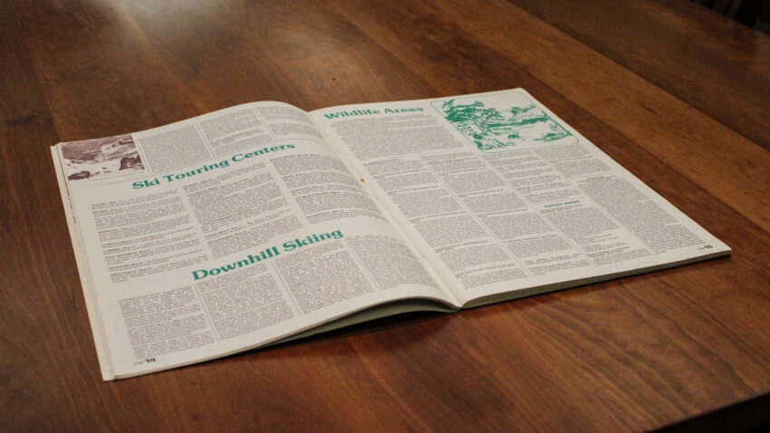
Initially, I was unfamiliar with a “gazetteer,” only knowing gazette in the context of newspapers, but I learned that it is like a geographical almanac. The first edition of the Maine Atlas and Gazetteer included so much information, detail, and vibrant images. Several pages have information on the best rivers for canoeing, the best hiking and biking trails, the various wildlife areas (including Scarborough Marsh and Mast Landing in Freeport), a list of state parks and campgrounds, and a self-proclaimed “Tour Along the Maine Coast”—which was mostly lighthouses—including detailed and helpful directions from Portsmouth, NH, to Calais, ME. It also details your access rights to the woods and water which I found a fascinating touch.
And this is just the first 15 pages.
DeLorme also includes a list of post-secondary schools, including the now-defunct private liberal arts women’s school: Westbrook College (now the University of New England’s Portland campus). He also highlights the University of Maine System (UMS), detailing each campus: the “Portland-Gorham” campus, a short-lived name in the 1970s, and “Portland College of Art” which is now Maine College of Art & Design (MECAD). The gazetteer also includes a lengthy review of Maine’s economy and a section titled “An Early History of Maine,” a description of Maine’s history from when it was an ice shelf about 13,000 years ago to the Revolutionary War, and a list of historical places of interest.
Seventeen years later, DeLorme published a New Hampshire Atlas and Gazetteer. To see the comparison in information and design from 1979 to 1996 was fascinating. The 1996 NH publication included a lot more information about wildlife and fish for hunting purposes, where the 1979 Maine version was less overtly about hunting big game. In 1979, DeLorme included about ten animals (not including moose, which I found curious) and six fish species. The 1996 NH version features not only sixteen species of fish and a table for where you can find them (divided into warm and cold bodies of water, though the only species that wasn’t in both is the rock bass), but twenty-two birds and mammals split into big and small game, game birds, and fur-bearing animals with a similar table. Incidentally, this provides interesting environmental data of how common certain species are (i.e. you can fish in any body of freshwater in New Hampshire and catch a trout, but bobcats are hard to come by). The New Hampshire gazetteer also includes a specific section for camping and hiking in the White Mountains as well as both topographical and street maps for the entire state.
If this wasn’t enough information for you, consider making a research appointment at the Osher Map Library; Jess is happy to help you find what you’re looking for.


Always glad to read more about my brother. He is quite the guy of whom I am proud.