By Asha Tompkins, Community Editor
It’s unlikely that Portland, Maine is associated with the stomping of feet against cobblestone roads at midnight, with stowaways rushing to hide in unfamiliar houses. However, Portland was a significant part of The Underground Railroad.
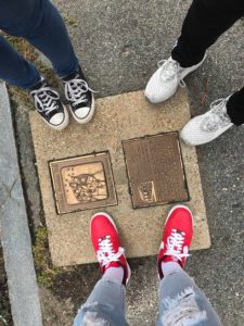
In 2006, locals joined forces to create a map using the history of the known area to create what is now known as the Portland Freedom Trail. Some of the participants included Portland artist Daniel Minter and Representative Rachel Talbot Ross. Dispersed throughout the city are Minter’s handcrafted placards, which marked the most significant sites on the trail.
“Although we have this idea of Maine being this ‘white state,’ we actually have a rich multi-ethnic, multicultural, multiracial history,” director of the USM honors program, Dr. Rebecca Nisetich said.
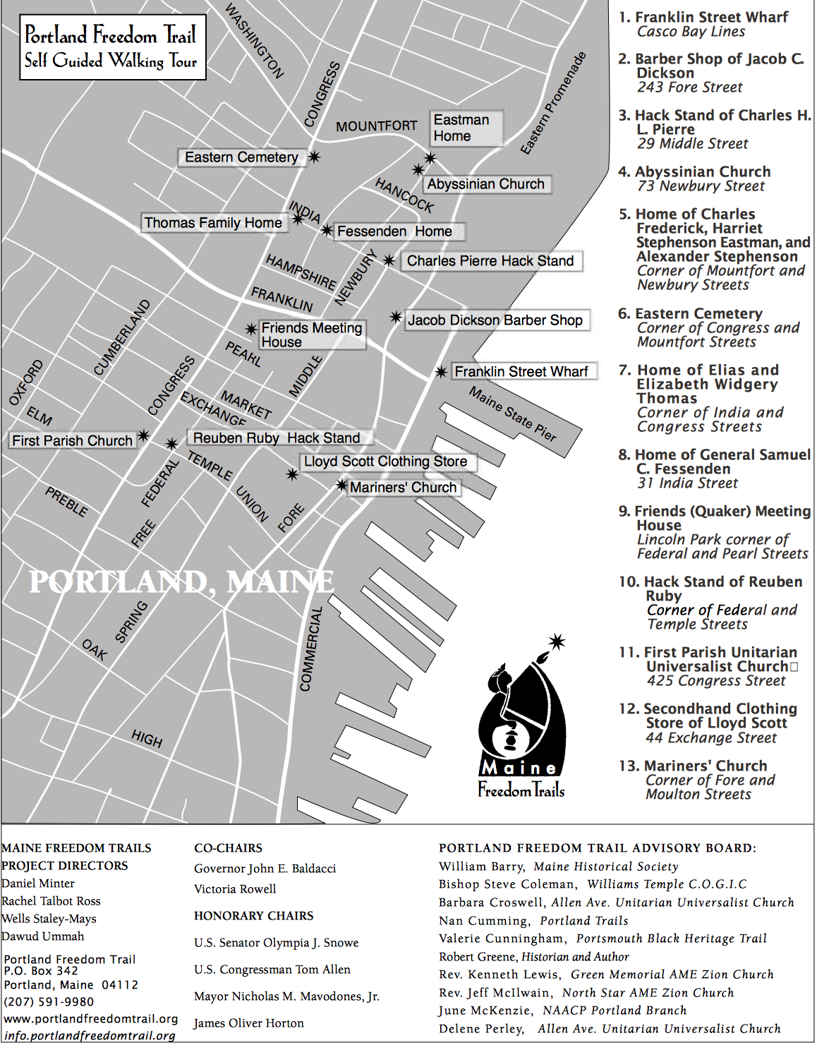
The first of the markers was installed at the Eastern Cemetery in 2006. However, this self-guided walking tour officially starts at the Franklin Street Wharf, where slaves once arrived as stowaways, and leads into downtown Portland.

“The first time I walked it (the Freedom Trail), I was like ‘where am I?’” said Nisetich. “It’s disorienting in a really productive way.”
A person roaming the trail may expect actual buildings to walk through and experience, however, most of the physical buildings no longer exist; yet, the stories remain to be told. The trail is dotted with engraved stone markers that explain the history behind the locations and the people involved with helping people escape from slavery.
“My dream one day is to take the Freedom Trail and build a free app that you can download and follow with your phone,” said Nisetich. “Right now it just exists as a PDF.”
Nisetich pointed out that an interactive map would be a better way to familiarize people with that part of Maine’s history.
“The Freedom Trail is a really great thing to introduce students to, because it’s tactile, you’re walking through the spaces where these people lived,” Nisetich said.
The downloadable pamphlet is a hand-drawn map with short descriptions of the stops on the trail. There’s no particular order in which the map directs you—it’s up to the traveler to decide. While it begins at Franklin Street Wharf, there are 13 logged stops with a final destination at the Mariners Church.
“Looking around an area that is in the process of being gentrified and has changed a lot and recognizing that this was a very different space originally 150 to 200 years ago gives you a really interesting way of almost travelling back in time and seeing that there’s more than one history of a space,” Nisetich said.
She added that when an individual walks the Freedom Trail, they experience layers of history.
“You’re seeing where things used to be and where things are,” said Nisetich. “You’re also seeing what we value. It’s cool that we have a freedom trail, but we can also do more to preserve the spaces we have left.”
While many of the stores and locations on the trail are in the process of being renovated, some areas are still worn down.
“Seeing those buildings abandoned and boarded up is saying something about where we place value,” Nisetich said.
Regardless of the weathering of the buildings on the breezy Maine coast, walking the Portland Freedom Trail, a completely free activity, still holds a rich historical significance in a city over 230 years old.


Leave a Reply